(auf Karte anzeigen)
12:15UTC+2

13.08.201911:45UTC+2
Family Cruising in Vanuatu and Papua New Guinea
Summary
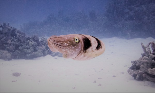
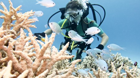
We, a family of four, visited Vanuatu and the Louisiades of Papua New Guinea from September to November 2018. Despite spending far too little time in these most interesting and diverse places, we truly enjoyed meeting and trading with locals, exploring beautiful beaches, snorkelling between a large variety of corals and reef fish and hiking jungle, caves and volcanos. As cyclone season was approaching we only gained a glimpse of the hundreds of islands and had the chance to meet few of the most welcoming people, but were still rewarded with amazing memories. Herein, we report our highlights, our trading and cruising experiences and detail our anchorages as well as the services and facilities we found.
Our highlights:
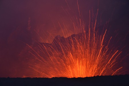
- Feeling earths unstoppable force at Mount Yasur, Tanna
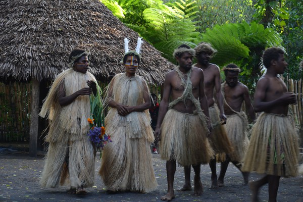
- Getting in closer touch with Vanuatus culture in the Maskelyns
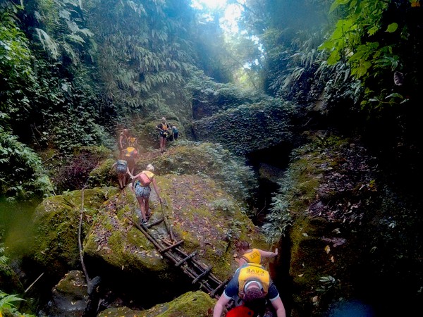
- Trekking, canyoning and cave climbing in the Millennium Cave, Espiritu Santo
- Exploring WWII equipment at the bottom of Million Dollar Point, Espiritu Santo
- Sailing into a volcano at remote Ureparapara, Banks Islands
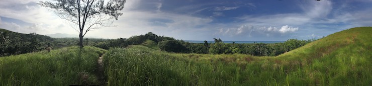
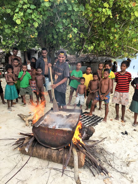
- Visiting remote villages in the lush green hills of Sudest Island
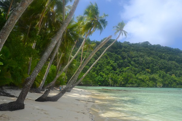
- Enjoying the beauty of the limestone island of Saberi
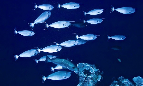
- Snorkelling one of the reefs at Epoko, Rennard Islands
- Sailing a local outrigger at Kimuta, Rennard Islands
- Trading fresh produce from remote villages in Vanuatu and PNG
General note
Most of Vanuatu and also the Louisiades are quite remote areas with very limited infrastructure especially for yachtsman. The last stop for major provisioning (more expensive as compared to Tonga and Fiji), fueling and obtaining spare parts on the way from Vanuatu to Indonesia is Port Vila, if one doesn’t plan a visit in Port Moresby or Australia.
Vanuatu
With it’s 83 Islands and rich cultural background with over 100 languages, Vanuatu is a country were we could have easily spent months if not a whole cyclone season. As we were late in season heading northbound, we picked just a few anchorages from more than 100 described in the free Vanuatu cruising guide, which was very helpful for our stay.
Safety
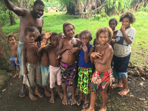
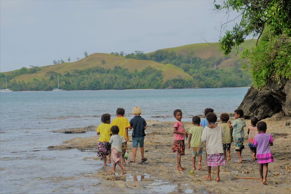
The Ni-Vans are very welcoming people, ready to give without expecting anything in return. Outside of the urban centres Port Vila, Efate and Luganville, Espiritu Santo we experienced people as poor, in need of virtually anything (also basic supplies such as rice and sugar). They still would not beg but offer local produce from their gardens. Soon we figured that this was their way of trading and gave something in return. They were happy with anything we could spare (see trading section for details) and if asked were also communicating their biggest needs. At the more remote islands, especially in the Banks islands, people, kids first, would paddle out to our boat saying hello and for trading and were most honoured if invited on board for a coffee. Inviting locals on board may be a double edged sword as it may create opportunity for theft, therefore other cruisers have been hesitant about having locals aboard. During the length of our stay we never felt unsafe or had any negative experience, also not in the urban centres.
Formalities
Lenakel (Tanna), Port Vila (Efata), Luganville (Espiritu Santo) and Sola (Vanua Lava) are the official ports of entry to enter Vanuatu.
Inbound: As the bay in Lenakel is rather unprotected against prevailing winds, we preferred clearing into Vanuatu at Port Resolution, Tanna. Inbound clearance is possible after seeking approval by Tanna customs 48h in advance (customsborder@vanuatu.gov.vu). We sent multiple emails but never received a reply, thus went ahead and anchored at Port resolution without gaining advanced approval. When we entered the bay around noon, five other cruisers lay at anchor at Port Resolution, two of them just have been cleared in. The customs officer saw us approaching but had to leave. He had promised to come back the same day. Upon anchoring we beached the dingy in the northeastern corner of the bay and contacted Johnson from Port Resolution yacht club, who organised our inbound clearance as well as the ride to Lenakel and the tour to the volcano. At 5 pm the customs officer arrived the second time that day in Port Resolution after a 3h ride (one way) from Lenakel. He was most welcoming and completed the paperwork for inbound clearance including immigration. As we did not have enough Vatus to pay the clearance fees (8000 Vatu approx 72 USD for customs including his traveling expenses plus 1200 Vatu approx 11 USD per stamped passport), we needed to visit his office after drawing money from an ATM in Lenakel the next day. We received a sealed letter to be handed to customs in Port Vila (located at the container terminal) for completion of clearance.
Outbound: As we were heading northbound and visited the Banks islands the logical port for outbound clearance would have been Sola, Vanua Lava. As there is no ATM on Vanua Lava and we were unsure about upcoming clearance fees we decided to clear out already in Luganville, Santo. We were supposed to visit immigration, customs and the port office, but offices of immigration and port have been closed (public holiday). We have been able to complete outbound clearance just visiting customs. They stamped our passports and collected the fees (all together 7800 Vatu approx. 70 USD) for referring to the port office. Officially, we were supposed to leave the country within 24h after outbound clearance making our stay in the northern islands illegal.
Trading
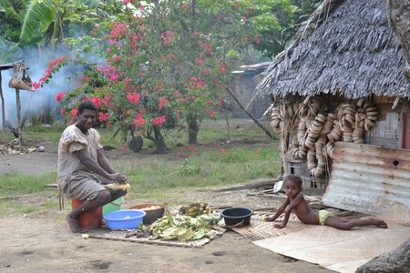
As we visited Port Resolution, we have been surprised about the remoteness of villages. Later we learned that villages on Banks and Torres are even more remote. With the next shop for basic supplies hours away, people are strongly relying on their own produce. Fishing extending reef fish is not common, as the dugouts are not adequate to fish in the open ocean. In our experience people on the outer islands preferred trading items over receiving money, as shops are far away and are not selling all requested items. Monetary income however is also important for the villages , as school fees for secondary school are expensive (primary school is mandatory and free). In some villages, the whole village was saving money for one kid to go to one of the centers to secondary school. Primary schools with proper water and electricity supplies were functional in even the remotest villages. We tried to support the villagers a bit buying souvenirs and trading deals, giving more than we received.
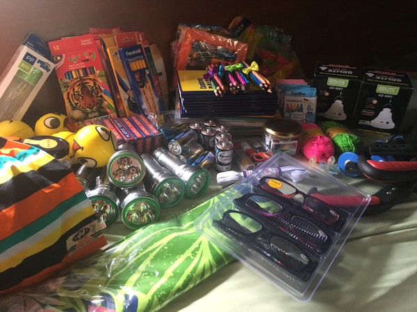
What we have been asked for:
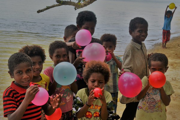
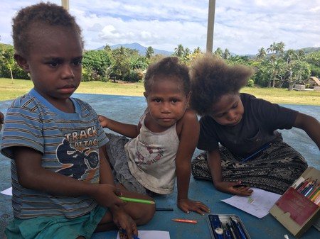
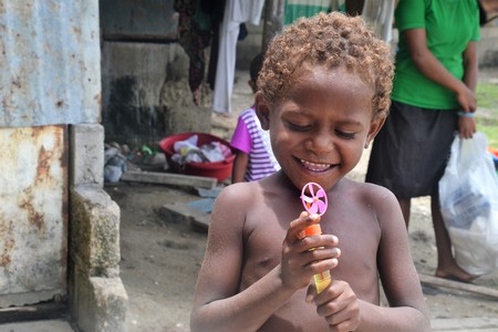
- Kids usually asked for candy, before anything else. Lollipops were well received as were ballons, water bubbles, penciles, pens and notebooks. But they were also happy to get a cookie and adorably shared among themselves, in case we had not enough cookies for everybody. We tried to collect the packaging to not produce a trash issue in the very tidy villages. After getting a treat, kids usually ask for a shirt or shorts. The most precious trade for them was a ball, which we only understood after seeing them play with roundly stuffed empty rice packages.
- Women always first asked for kids cloth. They were taking all sizes and distributing things if not fitting their own children in the large families. They also asked for basic supplies such as rice, sugar, flour, salt, oil, yeast, tea, soap and matches. We figured, that it also helped to add empty jars to the trade, as supplies are wasted when getting wet and the huts made out of palm leaves and bamboo often are not rain proof.
- Men ask for the same things as women, but would also request more specific, high value items such as: -- fresh fish. (Protein is scares, men often asked first for a fish to extend their menu.) -- shirts for themselves or their wives -- bandages and pain killers. The next hospital or physician is often miles away on other islands and people are usually using herbs in the absence of western medicine. We only supplied bandages to private people as we were not sure about the appropriate use of medication. Our spare medication on board we supplied to a hospital. -- diving masks, snorkel and flippers were one of the most requested items. Especially the masks are very high value for catching cray fish (and collecting sea cucumbers in PNG) -- fishing hooks and lure. As the Ni Vans are mostly only catching reef fish, small and medium size hooks and lures have been demanded. -- most of the houses have no light at all, thus people ask for torches and batteries, mostly D cells, LED bulbs and connectors as well as solar lights. -- tools for wood carving and building the dugouts. Chisels and saws were high value items. -- Many times we have been asked for old magazines, which we were sorry to not have, as it probably would have been entertainment for the whole village.
We have not been actively asked for needles, rubber bands and fabrics, but items were very well received when we offered them.
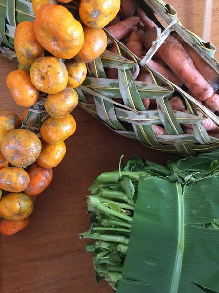
What we received in return:
- island cabbage, basically green eatable leaves in all forms (which we did not like)
- pak choy
- sweet potato
- yam
- spring onion
- choko (nice local vegetable eatable raw and in stir fries)
- papaya
- pumpkin
- drinking coconut
- banana and plantains
- sometimes tomatoes and cucumbers
- sometimes cray fish
- eggs are difficult to trade as locals usually do not collect them, but eat the chicken.
Souvenirs and services we always payed in cash.
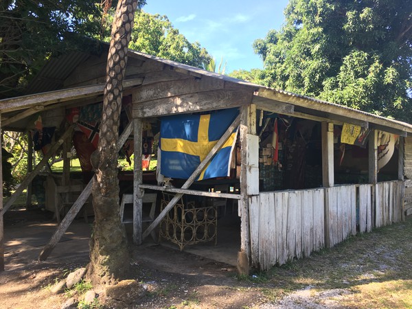
Port Resolution, Tanna
Navigation
The approach to Port Resolution is neither buoyed nor lit. The entrance to the wide bay is rather narrow, but straight forward when entering during daytime in the middle between the land masses. Navionics Charts are on spot.
Mooring
We anchored in 7 meters, more or less in the middle of the bay 19° 31.5' S, 169° 29.7' E. Holding was good. There are several bommies in shallower waters on the eastern and northern side of the bay, thus we had to navigate carefully even with the dingy.
On Land
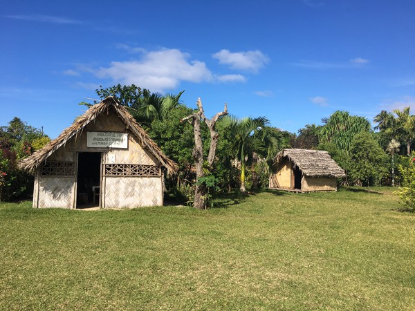
The yacht club is located on the north eastern side of the bay. There is no dingy dock, thus we beached the dingy and went up the small path to the top. The guys from the yacht club are organising clearance procedures, tours to the volcano Mount Yasur and transport to Lenakel (roundtrip 4000 Vatu approx 36 USD). We joined a tour starting in the afternoon, enjoying the sunset at Mount Yasur, which was an intimidating but absolutely amazing experience. After nightfall the magma was glowing red and the eruptions much better to see. We needed to dress warm though, the winds have been freezing up there. Admission fees for the entrance to mount Yasur were 9500 Vatu (approx 86 USD) per person (kids 4 years and below were free of charge), transport from Port Resolution to the Entrance gate and return was 2500 Vatu (approx 23 USD) per person (no charge for kids).
 The village is a 5 minutes walk from the yacht club. There are two small restaurants offering Tanna coffee and lunch or dinner. For eating, both preferred booking one day in advance.
On the southern side of the bay we visited the hot springs, cooked some eggs in the almost boiling waters and had coffee in the restaurant close by. From there it is possible to hike to another village through the jungle and see the steam geysers. There are also other hikes in the area we didn’t do.
The village is a 5 minutes walk from the yacht club. There are two small restaurants offering Tanna coffee and lunch or dinner. For eating, both preferred booking one day in advance.
On the southern side of the bay we visited the hot springs, cooked some eggs in the almost boiling waters and had coffee in the restaurant close by. From there it is possible to hike to another village through the jungle and see the steam geysers. There are also other hikes in the area we didn’t do.
Services & Trading
- There are no shops in Port Resolution.
- We traded some fruits and vegis from local women
- We went to Lenakel to buy some vegis and a SIM card (Digicel and credit for one month 2500 Vatu approx 23 USD).
- Internet coverage via the SIM card worked mostly ok at Port Resolution.
- Very basic supplies are available in Lenakel also, but it is much better to arrive stocked up.
Passage from Tanna to Efata
The 150 nm passage from Port Resolution to Port Vila has been a fast one with strong easterly winds. Seas have been moderate to rough.
Port Vila, Efata
Navigation
Port Vila is located on the eastern side of the Mele Bay, protected by two islands and surrounding reefs. Thus winds and swells have been much weaker after entering the mooring area. The approach to the mooring area on the east side of Iririki Island is buoyed and lit, but even though shallow at a few spots, especially after the last buoys. We therefore left and entered the bay during the day at a rising tide.
Mooring
Before entering the inner harbour we requested a mooring buoy from the yacht club via VHF. A small boat has been sent to guide us to a ball (1600 Vatu/night, approx 14 USD). The buoys looked well maintained. Alternatively, it is possible to tie up to the pier.
On Land
There are many restaurants in town to choose from. We don’t have a particular one to recommend. As port vila is the capital several tour options are available at relatively expensive admission fees, e.g to cascades, snorkeling, traditional villages. As we came mainly for provisioning we did not join any of them.
Services & Trading
- Internet is available via Digicel SIM card.
- There are several china stores in town as well as Bon Marche western style supermarkets. The biggest Bon Marche is located up the hill at Pango road, assortment is great, but not cheap though. This was our last chance to buy any magazines until Dili.
- The local farmers market is located directly at the waterfront, offering a variety of local fresh produce at very reasonable prices. Imported fruits e.g. apple, potatoes and onions are available in the Bon Marche markets.
- The Yacht Club has a fuel dock and offering diesel for 136 Vatu (approx 1.23 USD)/liter. If you are heading north, this might be your last chance for a very long time to get fuel directly pumped into your tanks.
- Rubbish can be disposed at the yacht club and laundry services is available (500 Vatu for one load, washing only).
- There are also several hardware stores in town, a specialised chandlery we couldn’t find. Maybe the yacht club is able to support in importing spares. Outside of Port Vila it will be even more difficult to obtain spares.
Mele, Efata
Navigation
We spent one night in the Mele Bay behind Mele island. The little island is surrounded by a reef, therefore we approached the anchorage during the day, well to the south before turning in and anchoring between the mainland and the island.
Mooring
We anchored at 17°41.7 S, 168°15.9 E in 10 meters over sand, close to the local boats on moorings. The island protects the anchorage from southerly swells, but it is pretty much open to winds from the south. Holding was good.
On Land
- It is possible to visit Mele island with its surrounding reefs and its under water post office. It is supposed to be a great snorkelling spot. Admission fees are for a whole day and quite expensive, though. As we wanted to stay only one or two hours we decided against a visit.
- Directly on the waterfront, next to the jetty, the Beach Bar is located offering western style food and cocktails.
- On the other side of the jetty souvenirs are sold.
- From the jetty it is possible to walk to the cascades (3 km) or to the secret gardens (2 km). There are also taxis waiting to take you around.
Services & Trading
- TWifi for customers of the Beach Bar or by Digicel sim card.
Passage from Efata to the Maskelyns
We left Efata before sunset and sailed the 85nm to the Maskelyns overnight with quite strong winds and moderate to rough seas from the SE.
Uliveo, Maskelyns
Navigation
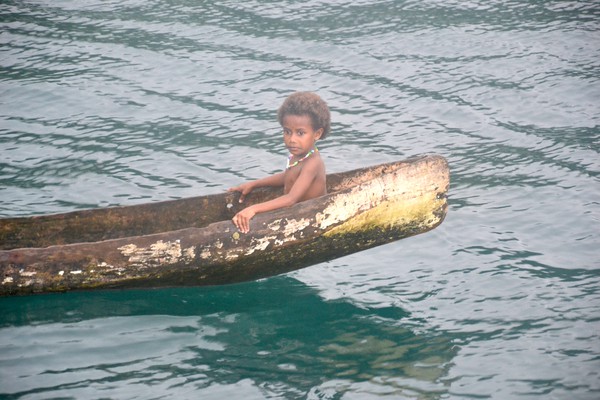
The approach to the anchorage of Uliveo is a bit tricky. We needed to pass through a quite narrow gap in the reef. A local in a dugout was guiding us, but a good lookout might also be able to give directions as the reefs are clearly visible in the water. Once the gap was passed water levels dropped again.
Mooring
We anchored in front of the village (16°31.8' S, 167°49.8' E) protected from SE winds and swells.
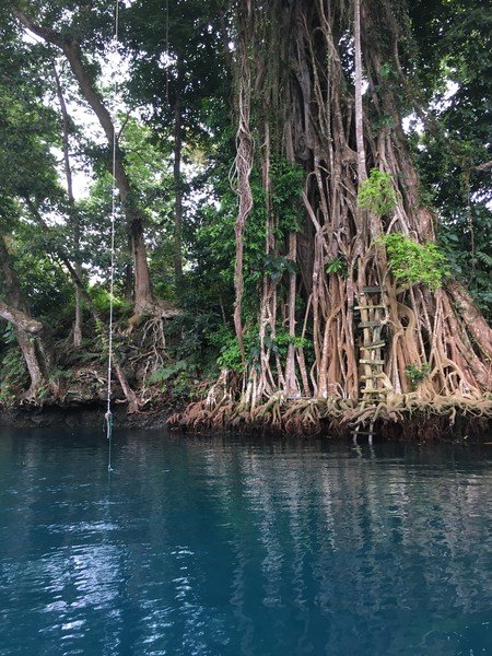
On Land
- Stewart and Phillip are contact persons for cruisers. They are very welcoming, organise small nambas customs dancing, local food and organise trading with the villagers.
- We were invited to Phillips house, where we enjoyed local foods cooked in bamboo and weaving lessons from the women.
- It is possible to visit giant clam sanctuary in the neighbour village, which we didn’t do.
- Around the corner is some quite amazing snorkelling, the visibility is not perfect though. Ask the locals.
Services & Trading
- Services: None.
- We traded fruits from locals.
Passage from Tanna to Efata
We left the Maskelyns in the evening and arrived in Santo the next morning after a moderate to rough overnight sail in significant SE winds. Arrival is best to be timed on the tide, as there are significant currents around Luganville.
Luganville, Espiritu Santo
Navigation
The approach to Luganville was straight forward. Tidal currents are significant here and worth to be considered.
Mooring
We initially wanted to anchor in front of the Santo Hardware store, however the anchorage in front of the town was barely protected against SE winds and swells. We therefore continued 1 nm further west and anchored in a large, much better protected bay in front of the Beach front resort (15° 31.3' S, 167° 9.9' E). Holding was good.
On Land
- The resort has a pool bar and restaurant. The pool can be used by customers.
- The Million dollar point can be reached by cab, at which dumped WWII equipment are reaching the beach and can be snorkelled. When we visited, water visibility was very poor as for the strong wind and swell disturbances. Visiting on a clam day would definitely be preferred.
- The famous wreck of President Coolidage lies also close to the beach and is accessible by snorkelling or better by scuba equipment.
- Visiting the millennium caves was one of the highlights of our Vanuatu visit. However, in our opinion a visit can only be enjoyed by physically active persons as it includes several hours hiking in uneven, muddy terrain. We do not recommend the tour for young children (<14 years) as the tour includes a few difficult climbing sections and a walk in the dark cave with water partially reaching the hip.
Services & Trading
- Wifi for customers of the resort or by Digicel sim card.
- Tours: Resort staff is supporting organising tours, e.g. to the blue wholes (which can be better visited from oyster bay), diving tours, the millennium cave tour. Rubbish can be disposed at the resort.
- Fresh local produce can be obtained at the vegetable market, which is in walking distance.
- There are several chinese shops in town, but no western style supermarket.
- Last chance to get Vatus from an ATM.
Oyster Bay, Espiritu Santo
Navigation
Oyster Bay is one of the best protected anchorages in Vanuatu. It lies behind several reefs and a few small islands, thus the approach is tricky. We entered the lagoon close to high water according to Navionics waypoints, which were at the spot. Nevertheless water depts are quite shallow in the initial approach when crossing the reef (at some spots 2.5m only). Daylight and a good lookout is required.
Mooring
We moored inside the lagoon, close to the resort (15° 22.4' S, 167° 11.4' E). Holding was good.
On Land
- The blue wholes are accessible by dingy, when going up the river just accross from the anchorage. There was a small entrance fee at the wholes. Drinks and snacks can be purchased at the small bistro.
- A plane wreck can be snorkelled in the lagoon, but we didn’t.
- Oyster Bay resort at the end of the lagoon is offering lunch and dinner and rents kayaks.
Services & Trading
- None, also no network coverage by sim card.
Passage from Santo to the Banks
We sailed a good part of the 85 miles during the night and approached Gaua in the morning. There was a constant significant SE breeze and moderate seas. A school of false killer whales visited Moya and swam with her for an hour or so, which was a fantastic experience.
Lesalav Bay, Gaua (Santa Maria), Banks Islands
Navigation
To access Lesalav Bay we entered the bay by a passage between the reefs, which is well charted by Navionics. The approach is not bouyed or lit.
Mooring
We moored in front of the little village (14° 12.5' S, 167° 34.2' E)
On Land
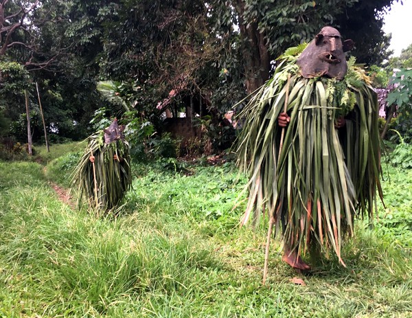
We heard that locals are organising tours to the vulcano, but we only visited the little village. Some people welcome us wearing traditional masks and costumes.
Services & Trading
- Internet coverage by sim card.
- No shops but locals are happily trading and asked specifically for fish.
Port Patterson, Vanua Lava, Banks Islands
Navigation
Before we entered Port Patterson, we checked the anchorage in Sola, which was poorly protected from swells. As we expected strong winds we decided to move to Port Patterson. The bay is much better protected against SE swells and the approach is straight forward.
Mooring
We moored as close to shore as possible to obtain best protection against swells (13° 49.5' S, 167° 33.2' E). Further inside the bay there are a couple of boomies. We anchored in 5m over mud. Holding was very good even in gusts of more than 50 knots (remainder of out of season cyclone Liua).
Services & Trading
- Weak signal by sim card.
- We didn’t go ashore given the rough conditions.
Ureparapara, Banks Islands
Navigation
The approach (not buoyed nor lit) inside the crater of the volcano during daytime is straight forward. Locals were paddling out to show us the best anchorage.
Mooring
We moored on the south side of the crater, close to the village (13° 32.5' S, 167° 20.5' E), not the anchorages charted by Navionics. Apparently, holding here is much better. Some swell is reaching the anchorage and also wind bullets shoot into the crater from time to time, both we deemed acceptable.
Services & Trading
- None. No network coverage.
- Indeed the people have been strongly in need of basic supplies such as soap, flour, rice, patrol, as the last supply ship arrived serval months ago and no local boat is capable to make the open sea passage to Sola or Santo.
- It was the place we felt as most remote from our travels in Vanuatu and PNG, were people had the strongest needs. Kids have been dressed in lumps.
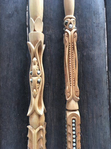
- Chief Nickelson was organising the trade with the villagers, mainly fresh produce and some wood carving, which is the only income of the island. In return they would virtually take anything we could give with soap, rice, fish, diving masks and kids cloth being on top of the needs.
- Despite being poor, hospitality on the island was breathtaking. When we went ashore we have been welcomed with flour necklaces and a walk through the village.
- If planning to go to Ureparapara contact chief Nickelson before, they would highly welcome also delivery of basic supplies.
Hayter Bay, Tegua, Torres Islands
Navigation
The little islands in front of the bay is surrounded by a reef, with breaking waves. We therefore approached from the NW.
Mooring
We found mooring in Hayter Bay tricky as sand spots between the reefs are small and water levels are deep. It took us two hours to find an acceptable anchorage in 12m over sand (13° 14.77' S, 166° 35.75' E). The bay is not perfectly protected against swells and little from wind, but it is probably the best option in Torres.
Services & Trading
- None. Also no Internet or phone service.
- The island is inhabited, but we didn’t meet anyone.
- Beaches are absolutely beautiful, nice snorkelling.
Passage Vanuatu to indispensable Reefs and to the Louisiades
Sailing between Vanuatu and the Louisiades was very enjoyable in constant SE winds. Especially the second half of the passage was quick sailing and good catching of fish. Initially we planned a stopover at the indispensable reefs, but couldn’t find a suitable spot for anchoring. The reefs are poorly charted, but google earth images are on the spot. At most parts the reef drop from basically zero to 60 m. The one location, where we could have anchored (around 12° 39.8' S, 160° 17.3' E), was 10m deep with sand and some boomies and quite protected in an inlay of the middle reef. We saw a number of dugouts, which must have been locals who paddled out all the way from Rennel. We left the place to find a better spot, which we never found. After 4 hours of searching the westerly side of the reefs we reluctantly decided to continue to the Louisiades. The reefs are beautiful with crystal clear waters.
Louisiades, Papua New Guinea
We visited only a few islands of the large archipelo of the Louisiades. We would have loved to stay longer to explore, but we were quite late in season. In the past the Louisiades have been visited by many yachts, but since the australien rally stopped, only few yachtsman find their way in the beautiful archipelo.
Safety & Health
Safety on the islands we visited was good. The only place were we felt not 100 percent comfortable was Missima harbour, but also here we haven’t experienced anything negative. We avoided PNG mainland and people aggregations. When we left the boat we always locked it and secured the dingy on land and during the night. Moreover, we stored loose deck items inside to prevent children taking them, as they sometimes climbed uninvited on board. Other cruisers avoided to have locals on board to reduce opportunities for theft or spying, but we invited locals who paddled out to Moya quite often and never experienced any issues.
Malaria on the islands is highly abundant. Locals even asked us for medication. We therefore always left the islands before nightfall and anchored in some distance to shore. As there always has been a light breeze, mosquitoes never managed to fly out to the boat. Medical infrastructure on the islands is spares. We visited the hospital on Nimoa, the only one on the eastern archipelo, which is run by nurses only. In case of emergencies it might be difficult to receive adequate treatment.
Trading
Trading in the Louisiades was quite similar as compared to Vanuatu (see section above), but the people on most of the islands were not as keen on trading as the people on the Banks. They also were not interested to trade for basic supplies such as rice, flour or sugar, which they basically can buy on any of the islands. Instead people asked primarily for snorkelling equipment, small to medium size fishing hooks, cloth, torches, solar light, medication and magazines. In return we received fruits and vegis, but selection was poorer as compared to Vanuatu, mainly bananas, papayas, sweet potatoes and island cabbage. People appeared not as poor as the people from Vanuatu’s northern island. Children were better dressed and virtually every village had a speed boat for traveling between the islands. We learned that villagers collect sea cucumbers and sell them expensively to China. That basic income is noticeable.
Eastern Approach
We entered the lagoon of the Louisiades through the snake passage (Yuma passage). The passage is not charted on Navionics, but google earth pictures are accurate. The passage through the reef is wide and more than 10m deep throughout the way and easily to navigate during daytime (we entered when it was raining). Outer entrance point is located at 11° 21.0' S, 153° 23.0' E from there the way inside the lagoon can easily made out. Exit point inside the lagoon is located at 11° 22.7' S, 153° 20.2' E. Further waypoints and passages are described on www.maranatha.id.au. According to locals the lagoon can be entered through snake at any tide without strong currents. That is in line with our experience.
Muhua Bay, Sudest Island
Navigation
Muhua Bay is close to the exit of the snake passage. The approach during daytime is straight forward.
Mooring
We moored in 7m over mud (11° 22.4' S, 153° 18.1' E) with excellent holding.
On Land
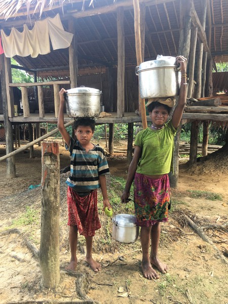
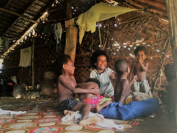
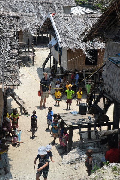
We were greeted by a few dugouts. The next day we went a shore and hiked to the small village up in the lush green hills. Micheal showed us around and invited us on his terrace. Apparently only few yachts come visiting. People are very welcoming, we even received a goodbye letter thanking us for the visit.
Services & Trading
- None. Internet coverage by digicel.
- We experienced locals here as the poorest compared to the other islands in the archipelo, accordingly they were keen to trade.
Tagula, Sudest Island
Navigation
Straight forward during the day.
Mooring
We moored close to the jetty (11° 19.6' S, 153° 12.7' E), docking is possible also. The anchorage is rather poorly protected and affected by tidal currents. Nimoa island is close and better suitable to stay over night.
On Land
Up the hill there are some administrative buildings and houses with nice gardens.
Services
It is usually possible to get SIM cards in the small store selling basic supplies, but they were sold out at our visit. The only other store selling SIM cards in the area is located in Missima.
Nimoa Island
Navigation
The anchorage should be approached during daytime with a good lookout. Navionics charts are not very accurate, as in most parts of the archipelo.
Mooring
We moored between the reefs over sand (11° 18.0' S, 153° 14.7' E). The anchorage is well protected against SE swells and winds.
On Land
We visited the hospital and school, both located on the southern end of the bay. The hospital receives supplies only two times a year and was thankful that we donated some medication. We met a lot of children, all of them nicely dressed, which we think is an indicator for the increased standards on Nimoa island.
Services & Trading
- No internet coverage.
- Small store selling very basic supplies.
- Some locals paddled out for trading
- Hospital.
Saberi Island
Navigation
The passage from Nimoa to Saberi is rather shallow with several reefs in between, which are not properly charted. A good lookout is essential.
Mooring
We anchored behind the fore lying lime stone islands at position 11° 07.3' S, 153° 05.1' E over hard sand. The spot is nicely protected against swells.
On Land
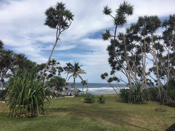
There is a cave in one of the fore lying islands but entering is quite difficult. The lagoon behind the islands is scenic and ideal to swim at the small beach 200 m east of the village.
Services
- No internet coverage.
- Little store selling very basic supplies.
- Locals traded beautiful large shells as they are not growing fresh produce on the island.
Epoke, Rennard Island
Navigation
We left the lagoon of the Louisades through the Chubudi passage. The passage is not accurate charted in Navionics, the real passage is shifted to the west. There can be quite strong tidal currents in the pass, thus entry or exit should be timed to slack water. Epoke island is a small island with a large surrounding reef, thus we recommend to approach the anchorage only during daytime with good visibility.
Mooring
We moored behind the reef on the NW side of the island over 8m sand between few bommies 10°52.9 S, 153°09.4 E. The anchorage is protected against SE swells, holding was fine.
On Land
Beautiful beaches, hermit crabs and good snorkelling.
Services
None, also no internet. The island is uninhabited.
Kimutu, Rennard Islands
Navigation
There is a small lagoon in the reef north of Kimutu. Entrance inside the lagoon is difficult. We recommend a good lookout and ideally support by locals. Navionics charts are not showing the lagoon and the passage at all. Phil Bailey from SV Maranatha www.maranatha.id.au describes the passage as dim passage (local word meaning white man) and provides on spot waypoints.
Mooring
We moored behind the reefs (10° 50.4' S, 152° 59.2' E) in 5 m over sand. Holding was not great though.
On Land
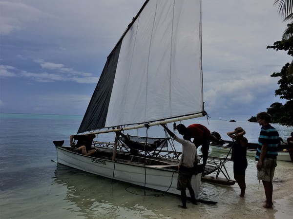
There are two beautiful, little villages, which are rarely visited by cruisers. We were the second yacht in 2018 when we visited the village at the end of October. Locals were very welcoming and invited us to the church service on sunday and to a boat tour on a local outrigger. Beautiful beaches.
Services
- None, also no internet.
- Locals happily traded bananas and mangos.
Bwagoia Habour, Missima Island
The town is not nice, stores are not well stocked. Our only reasons to come: eggs and internet.
Navigation
The entrance to the habour is marked by white poles and also lit during the night. We still wouldn’t recommend entry during the night as reefs are close.
Mooring
We moored close to the dock, leaving room for local vessels to manoeuvre 10° 41.3' S, 152° 50.8' E over mud.
Services
- Internet: SIM cards can be purchased in two of the shops.
- Money: There is no bank (there used to be, but it closed) and also no ATM on the island. The korean shop owner accepts USD and also changes to local currency at reasonable rates.
- Local market offering very limited selection of fresh produce mainly beetle nut, sweet potatoes and island cabbage. No tomatoes, cucumbers and almost no fruits.
- Grocery: the stores offering very basic supplies, cloth and basic kitchen items. We came to stock up before leaving to Indonesia, but provisioning was barely possible, better come stocked. But at least there were eggs on stock.
Nivani Island, Deboyne Islands
Navigation
Nivani lies in the Deboyne lagoon, but we didn’t time the entry to the lagoon to slack water and didn’t experience a major current.
Mooring
We moored behind Nivani island (10° 47.2' S, 152° 23.3' E) over sand together with four other yachts (almost the only once we meet in PNG). The anchorage is not perfectly protected from winds and swells.
On Land
- Snorkelling at a japanese plane wreck from WWII.
- Beautiful beaches.
Services
- Internet: rather poor coverage by sim card.
- Locals traded fresh produce, woven baskets and wood carvings.